
CATS Virtual Rider Location Map 2026
Map should refresh at 1 hour intervals
Riders’ icons will advance in 10 mile incremental steps
Map Instructions
- Click on the 3 small horizontal lines in the upper left corner to open the left info window
-- This info window contains rider names and icon colors
-- Check boxes allow you to turn on/off data as desired
- Click on the 3 small horizontal lines in the upper right corner to open the right info window
-- This info window contains basic ride data for all riders
- Click on any icon on the map to open an info window for that rider
- To ZOOM IN, use ctrl + scroll or use the +/- buttons
- After zooming in, drag the little man icon in the lower right corner onto the road to get a view of the actual street you are on! (Once in street view mode a left arrow will appear in the lower center of the screen; click it to go back to the overhead view.)
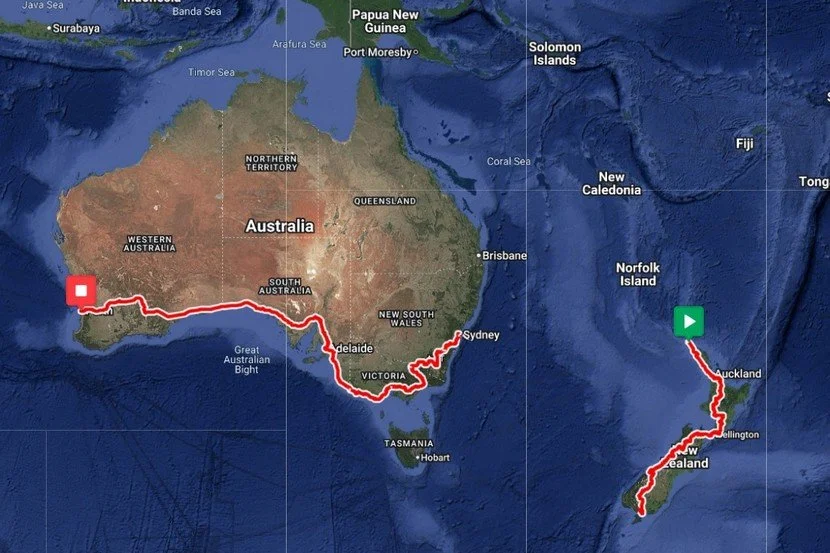
CATS Virtual Route Map 2026
This year’s virtual ride will take us to New Zealand and Australia! In the first segment we’ll ride 980 miles from the north to the south end of New Zealand's North Island. You will then hop into a Star Trek transporter where you and your bike will be dematerialized into a matter stream and transmitted across Cook Straight to the northern tip of the South Island where you will be rematerialized to continue your journey. You will then ride the length of the South Island for the next 850 miles. Once at the south end of the island, you guessed it, back into the Star Trek transporter for transport to Sydney Australia where you will begin the final (and long!) 3330 mile ride across southern Australia all the way to Perth! Total possible miles this year - 5160 miles!
Submit mileage using the Mileage Entry Form 2026.
Need your mileage corrected? Use our Contact Form.
Want to join our Mileage Logger and Virtual Ride? Use our Contact Form.